Tracking DPS Across the Sky: How We Did It
A version of this story ran in the June 2018 issue.
To find out where the Texas Department of Public Safety flies its two surveillance aircraft, the Texas Observer and the Investigative Fund teamed up to analyze commercially available flight data that recorded the paths of DPS’ two Pilatus PC-12 aircraft, purchased over the past six years.
Using the tail numbers of the planes — N219TX and N243TX — we obtained tracking data from Flightradar24, a commercial flight-tracking service. The data covers January 1, 2015, through July 31, 2017, and consists of points along the path of each plane’s flights specifying altitude, speed, latitude and longitude. Because the planes were using an imprecise transponder, which communicates information to ground receivers, Flightradar24 interpolated the planes’ locations based on data from multiple receivers. However, because such receivers are sparse near the border, a spokesperson for Flightradar24 says, each coordinate could be off by as much as 10 kilometers.
To map the flight paths, we converted the points captured for each flight into lines using ArcGIS Pro’s Points to Line tool. These estimated flight paths may be viewed in the “Flight Paths” tab. The individual points captured for each flight may be viewed in the “Flight Points” tab. Flight points that appear to be near the U.S.-Mexico border or inside Mexico may be viewed in the “Border Flights” tab.
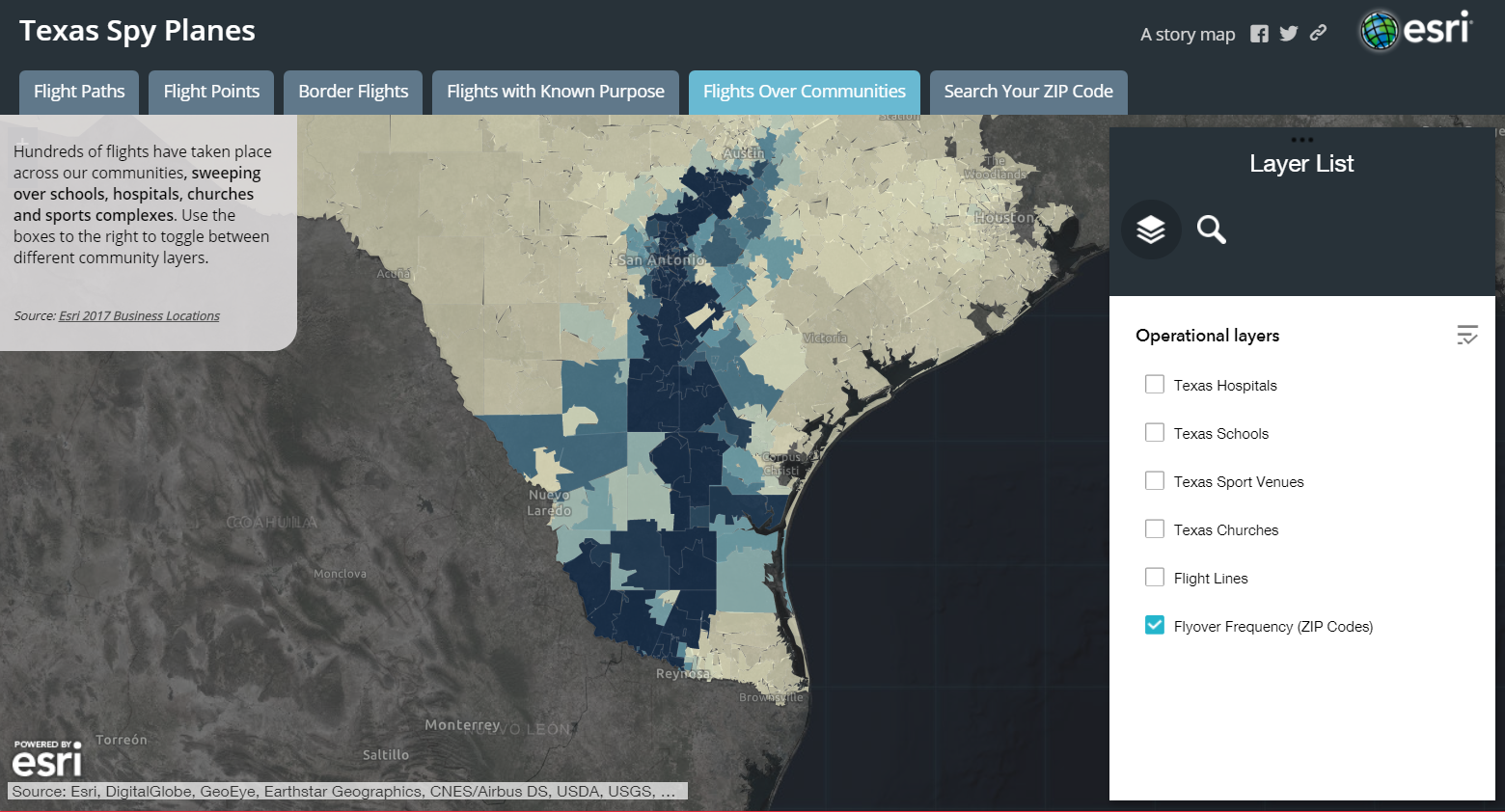
Through a public information request, we also obtained almost a years’ worth of DPS flight logs from 2015 to 2016 for one of the planes, which contain more detailed flight information, including each flight’s purpose and a list of any passengers. This information may be viewed by clicking on any flight path that appears under the “Flights with Known Purpose” tab. You can explore potential surveillance of neighborhoods and civic institutions in the final two tabs.
You May Also Like

Cycling the Rio Grande as Trump’s Wall Looms
“We’re gonna be riding around areas where most everybody thinks it’s unsafe, and you’re gonna see that there’s really nothing to be worried about.”

Can a Tejano Star Restore Dems’ Power in South Texas?
In his bid to win a Trumpy congressional seat, Bobby Pulido is blending his moderate message with charismatic campaigning.

‘Where Do We Go from Here’: Forward or Backward?
In our nation’s civil rights fight, we seem to be losing the hard-fought progress for which so many bled and died.