A River No More
Flowing rivers are the arteries of the vast Texas landscape. They connect the treeless sands of West Texas with the dark alluvial soils of the Gulf Coast. But the lack of rain has weakened the waterways that bind our state. The aridity that now chokes these rivers, from the Brazos to the San Saba, has set off a battle between rural Texas and the super-cities that now have the power. The cities are thirsty giants that never sleep, dominating our politics, our policy and now our water. They will not be denied. And even though there are very few actual river miles within these cities, the water winding through the long banks surely belongs to them.
In op-ed after op-ed, political leaders, business interests, policymakers and developers all point to the abundance of water held by agriculture. And so these farms and the rural lands of Texas will be sacrificed as the rains cease and the cities grow. It’s an easy answer to avoid the impending change and discomfort that should come with a dwindling water supply.
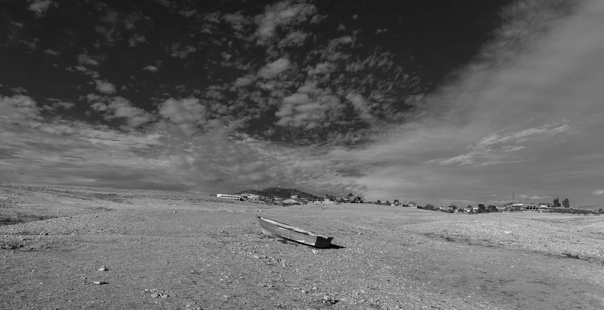
If you have watched the ongoing battle over the flows of the Colorado, you can see this dynamic in real time. The Brazos is the same, now under mandatory restrictions against upstream withdrawals for the benefit of a single industrial facility. The Colorado was historically a river. It begins on the Llano Estacado and runs more than 862 miles. The origins are not marked and appear to be no different than any other of the millions of acres in Texas. The beginnings of the Colorado are where few could ever see it. You couldn’t pinpoint it on a map, that place where the sparse rains begin to collect and channel what becomes the river.
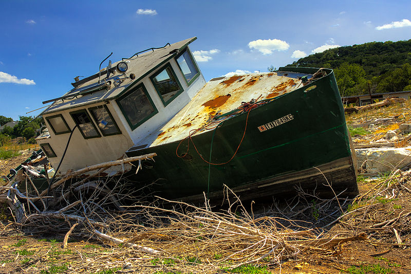
The Colorado’s still on the map as a river but the long flow has been carved into a set of possessory fiefdoms of water storage, marinas, resorts and second homes. Horseshoe Bay to the Lost Pines Hyatt. The water of the Colorado has been stacked until it’s a set of chained reservoirs. Time and money have converted the riverbank to cities, malls, developments and some of the most scenic areas in Texas. But it’s a façade and always has been. The illusion is performed with dams and development. Underneath, this was a river; we just lost sight of it.
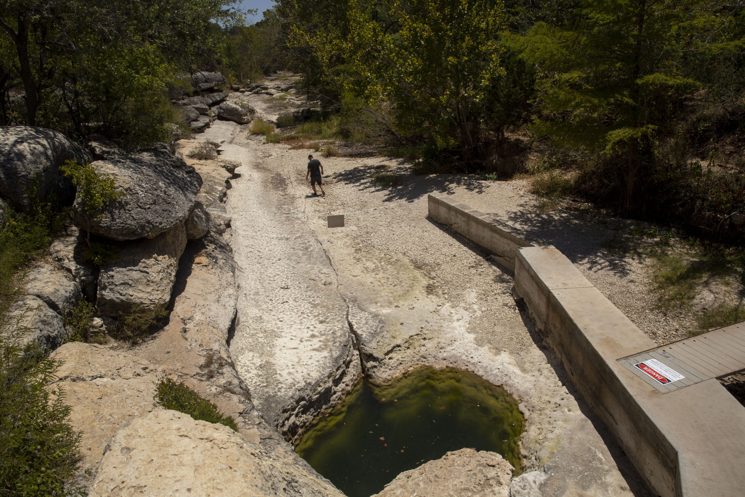
The many of us who are unwitting participants in this hydrologic demise can view a time lapse image from the rocky banks of Lake Travis. As the daily withdrawals of municipal intakes and the hot sun take hold, the flat surface of the water falls evenly. We know to the foot how much is lost every day. And as the water disappears, the islands emerge as though new lands have been created. But these islands are the old riverbanks that stood before the dams came. Even Lake Travis, the single biggest impoundment on the Colorado, has reassumed its serpentine shape. It’s a natural reminder that dam or no dam, this is a river.
We made a bet long ago that the rains would always come. So we failed to plan. Now the rains have ceased, and the demands are incalculable. The bet turned into a margin call.
The coastal farms and communities of the lower Colorado were the first to lose. Ironically the fathers of these farmers constituted the monolithic political power that enabled the original dams to be built. Over decades that power has waned to the point that it’s no longer viable. Once the dams that John Graves warned us about were built, the flow of the water would be controlled thereafter.
Now in a moment of desperation, the rich bays of coastal Texas are the next to pay. Shrimp, oysters, birds and redfish depend on the flow of fresh water to mix with the salt of the Gulf. That was the purpose and the effect of the long path of collected rains running from a silent spot on the Texas plains. Matagorda Bay thrived because the waters flowed. Without it, these creatures will be evanescent. And even though the farms and now the bays have been pushed out of the river’s path by the needs of a city, still the most Disney-like element of the Colorado remains untouched. Lake Austin remains full, gin clear and welcoming from the docks and front yards of the powerful—too many of whom are rarely there to see it.
This calls for a moment of thought. There is no leadership urging constraint. No call for slowed development or water-oriented growth planning. The wheel just spins faster. Every new development, every new apartment laid on top of bare Hill Country limestone drains a farm, a ranch, a bay and a life somewhere else. These places will slowly end before us because no longer does the water flow in what once was a river.
You May Also Like
‘With What Water?’
The shrinking of a mighty Mexican river has hollowed out the economy of Chihuahua’s Conchos Valley and bred civil unrest as South Texas demands the water it’s owed.
As Springs Dry Up, a Warning of Future Water Shortages
Heat, drought and booming population growth have stressed the aquifers that supply millions of people.

How To Prevent the Next Water Crisis
Amid droughts, climate change and development, Todd Votteler has ideas for how Texas can prevent future conflict over resources.