Customs and Border Protection Wants To Know What You Think About The Wall
A new "request for input" reveals the agency already knows its proposed path lies directly in the floodplain of the Rio Grande.
In late June, Customs and Border Protection (CBP) revealed the location of 95 miles of Trump’s new border wall in the Rio Grande Valley. Some stretches of the 95 miles had already been publicly identified by CBP, but the new “request for input” represents the first time the agency has released maps or asked for public comment for much of flood-prone Starr County.
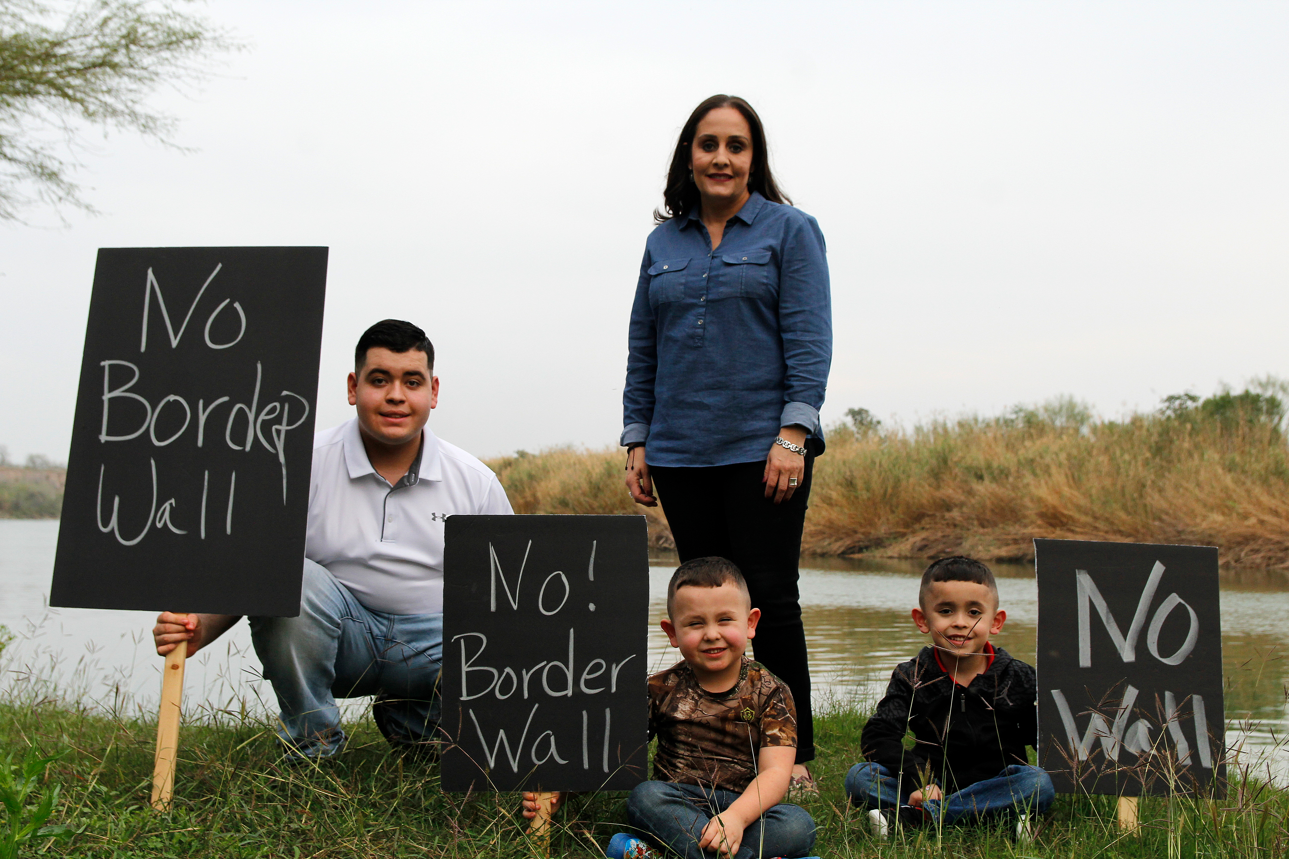
The new maps confirm what many have long suspected: All along the three border counties of the Rio Grande Valley—Cameron, Hidalgo, and Starr—hundreds of property owners in the path of the wall could lose their homes and farms. Tracts of the Lower Rio Grande Valley National Wildlife Refuge, including two where CBP ignored the suggestions of federal biologists, will be carved up. And alarmingly, 52 miles of border wall in Starr County will snake in and out of the Rio Grande floodplain.
The simple, clean lines on the maps belie the serious impacts that a wall will have on those of us who call the borderlands our home. As the Observer previously reported, a wall built in the floodplain will put communities on both sides of the Rio Grande at risk.

I live in the Rio Grande Valley, and I have seen the damage that a flooding Rio Grande can inflict. The idea that CBP would ignore the harm to property and the environment, and the possible loss of life, that Trump’s wall will bring is horrifying. But according to their plans, that appears to be exactly what CBP intends to do.
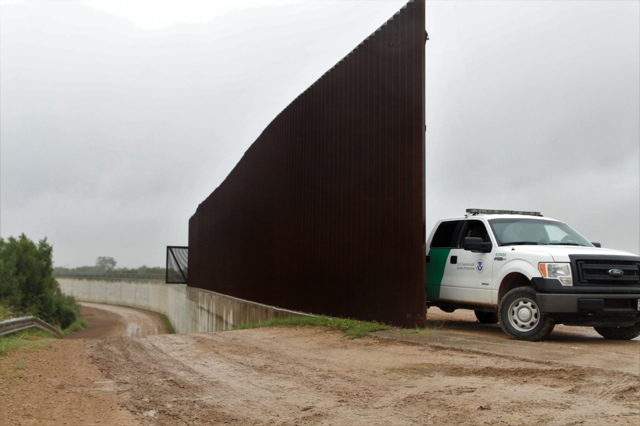
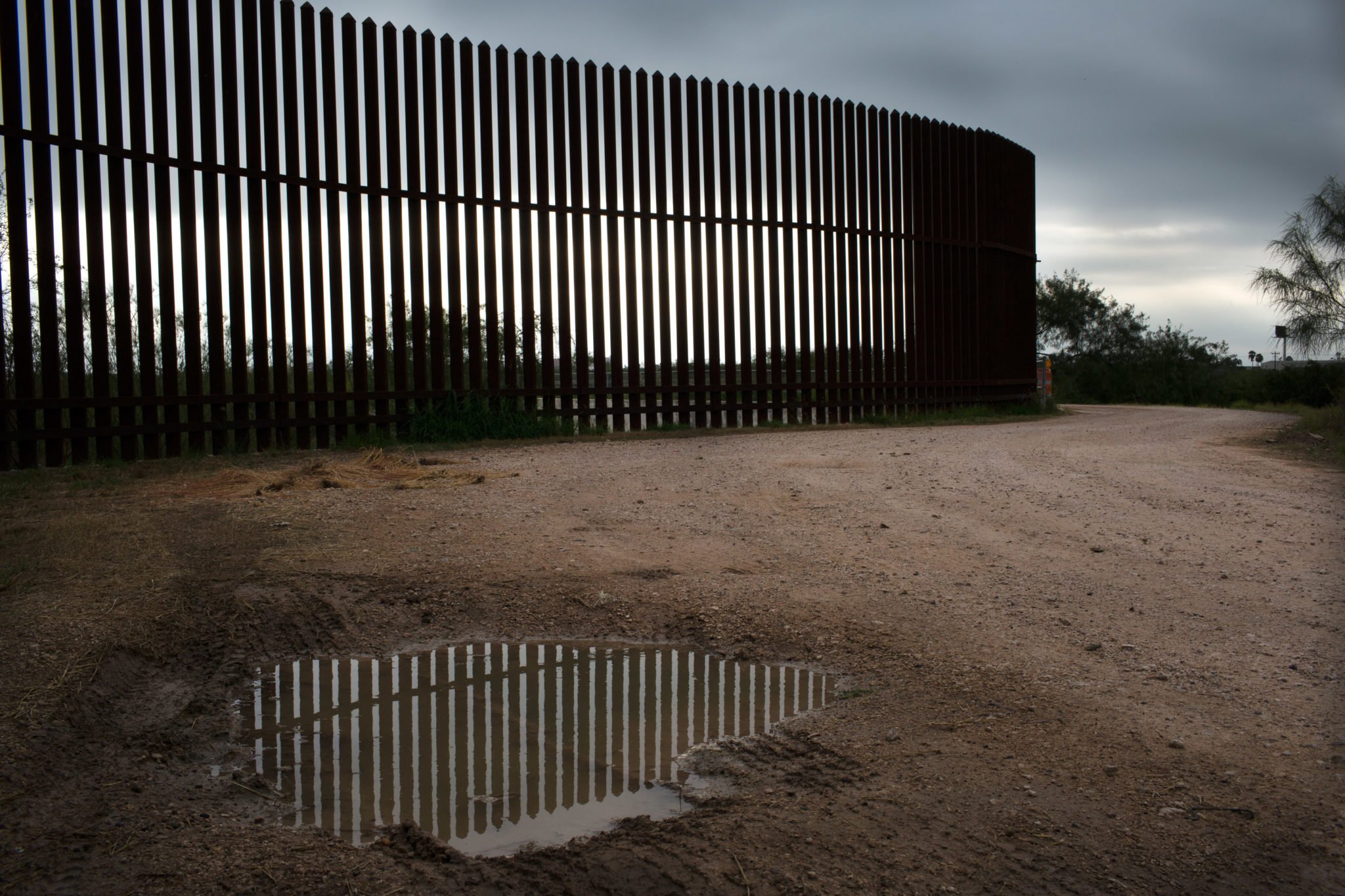
Towns in Starr County trace their history back to a time when steamboats plied the Rio Grande and Gulf of Mexico between Roma, Texas, and New Orleans. Here, CBP plans to build bollard border walls, consisting of steel posts spaced 4 inches apart that would stand 20 to 30 feet tall. According to the agency’s newly released maps, much or all of the wall in Starr County will follow the exact route that was depicted in a leaked 2018 flood model commissioned by CBP. That’s despite the agency insisting earlier this year that the leaked maps were outdated. The only sections still shrouded in uncertainty are those within the limits of Roma, Escobares, Rio Grande City, La Grulla, and Salineño. There, CBP is talking with local leaders about the wall’s exact alignment, as mandated by Congress in February, though ultimately the agency is under no obligation to alter its plans.
On the U.S. side, border walls will cross arroyos and drainages that today channel water out of towns and into the river. With border walls blocking the water’s flow, those drainages will back up, homes and businesses will be inundated, and people could drown.
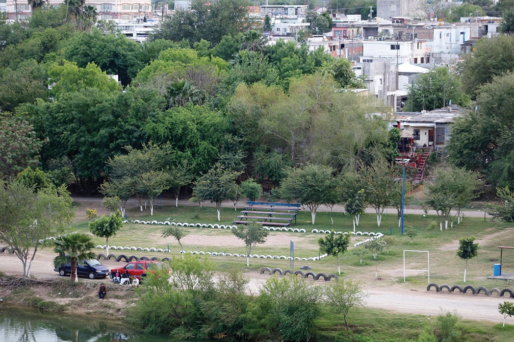
Mexican cities like Ciudad Miguel Alemán will see worse flooding when the Rio Grande swells beyond its banks. Water that would otherwise spill into Texas will instead be deflected deeper into Mexico, causing property damage and risking lives. It’s possible that walls will push the river to settle into a new channel, effectively moving the U.S.-Mexico border.
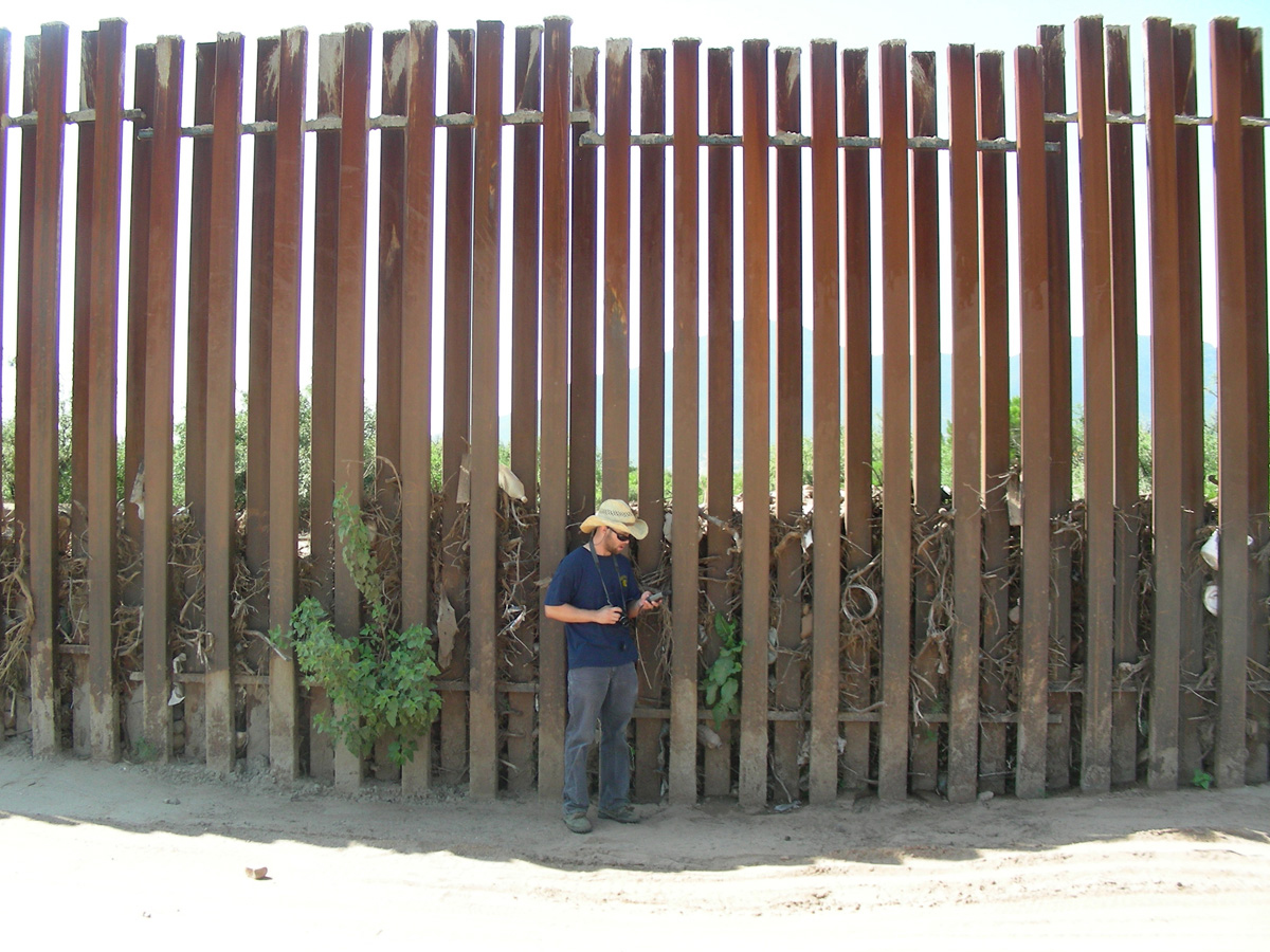
CBP would like to pretend that water will simply pass through the spaces between bollards. This notion has been disproven many times before. The space between bollards can quickly clog with debris, as branches, trash, and sediment carried by flood water are pushed against the wall, turning it into a solid dam. Yet CBP is choosing to ignore the evidence.
In 2007 and 2008, CBP built miles of bollard border wall—essentially the same design planned for Starr County—in California and Arizona. Where the wall crossed streams and washes, the gaps between bollards became choked with debris; when seasonal floods came, the wall backed up water as much as six feet deep. In 2009, the contractor that would create CBP’s Rio Grande flood models in subsequent years wrote that “fencing obstructs drainage flow every time a wash is crossed.”
So the agency spent millions of dollars retrofitting those bollard border walls with massive gates that could be raised to let flood water pass through. But raising those gates ahead of floods proved difficult. In 2011 a section of border wall in Organ Pipe Cactus National Monument was torn from the earth and swept downstream by floodwaters after the Border Patrol failed to raise a gate. In 2014, another section of border wall washed away on the outskirts of the city of Nogales.
According to last year’s flood model, there are no plans to build flood gates in Starr County. Instead, in some of the locations where the border walls cross arroyos and drainages, the bollards will be rotated, increasing the space between posts from 4 to 5 inches. The flood model assumes that the accumulation of debris will only fill 35 percent of the slightly wider space between bollards, without explaining why the bollard border walls proposed for Texas would only clog a little while existing bollard border walls in Arizona clog completely.
Since May, CBP has awarded two contracts for companies to build seven miles of wall in rural Starr County, in tracts of the Lower Rio Grande Valley National Wildlife Refuge and on either side of the town of La Grulla, with construction beginning as soon as this month. To hasten construction, the Secretary of Homeland Security has waived dozens of laws that would normally protect the environment and local communities for part of the seven miles. For the five areas with mandatory consultation, construction could begin after October 1.
The idea that CBP would ignore the harm to property and the environment, and the possible loss of life, that Trump’s wall will bring is horrifying. But according to their plans, that appears to be exactly what CBP intends to do.
The newly released maps were attached to a “request for input,” but the absence of critical information on the flooding impacts of the proposed border walls calls into question the sincerity of that request. Considering CBP’s track record in Arizona, residents of Roma, Rio Grande City, and other towns in the path of these walls have every reason to be concerned, and every right to see the full details of the agency’s plans.
Border walls are not just lines on a map or lines dictated for applause at a Trump rally. The walls that threaten my friends and neighbors are made of steel. They inflict real damage. And they could drown real people. If CBP builds this border wall, they will be abandoning their oath to “safeguard the American homeland” and “protect the American public”—instead sacrificing South Texas towns, people, and wildlife to please a president who does not care about us.
Public comments on CBP’s South Texas border wall plans are due by August 26 and can be submitted here.
READ MORE:
-
The Flood Next Time: Donald Trump plans to build his border wall in the Rio Grande floodplain. What could go wrong? Well, everything.
-
Texas Border Sheriffs: There is No Crisis and We Don’t Want Trump’s Wall: Local lawmen don’t believe a wall will do any good.
-
The Border Wall is More Expensive Than You Think: Trump’s wall is running taxpayers a cool $25 million per mile, up nearly fourfold from just a decade ago. But all that’s only part of the story.
You May Also Like
Engineer Who Helped Build the Wall Details Its Weaknesses
As you might have guessed, the U.S.-Mexico border wall is not very hard to get around.
Texas Teacher Could Lose Her Home If Trump Gets Any More Border Wall Funding
The feds are moving on Starr County land that they don’t have funding to build on yet. Congress could still stop them.
Documents Reveal Where Trump Plans to Build His Wall in Starr County
New maps show that the president means to build through 162 tracts of private land in Roma, Rio Grande City and La Grulla, possibly razing a number of homes in the process.