Flight Risk
As climate and habitat change in South Texas, where will all the birds go?
A version of this story ran in the May 2015 issue.
“It’s a bird’s-eye view,” refuge manager Gisela Chapa promised as we climbed the observation tower steps at Santa Ana National Wildlife Refuge. It was a cold and windy March day, and we’d almost elected to stay in the warmth of her government-issued Escape Hybrid SUV. But as soon as we reached the top it was plain to see why Chapa insisted we brave the weather.
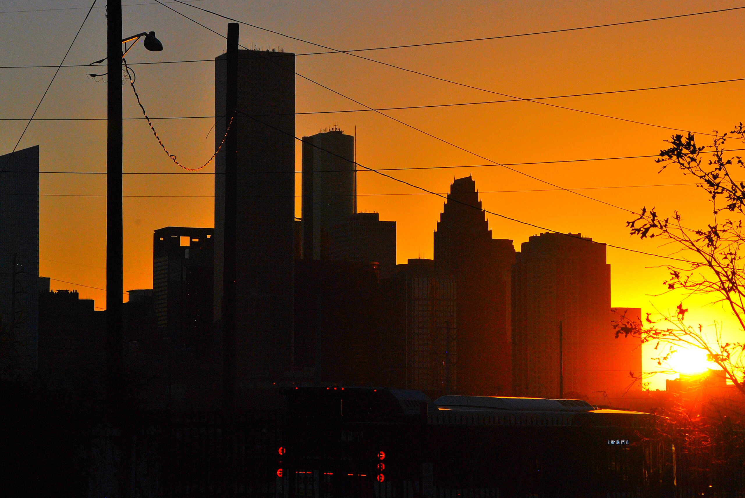
Bundled in a brown U.S. Fish and Wildlife Service parka, Chapa oriented me: To the south, factory smoke rising from maquiladoras in Mexico. To the west, the Chase Tower in McAllen, part of the fastest growing metropolitan area in the United States. To the north, Military Highway, with truck traffic carrying goods to and from the border. Everywhere, fields of kale and sorghum and sugar cane that encircle the refuge like a lasso.
“It’s the big-picture view of habitat connectivity, habitat fragmentation, urban development, the river and our neighbors to the south,” she said. “It’s my favorite spot. It synthesizes everything.”
The tower seemed like a propitious place to start, since I’d come to Santa Ana in hopes of understanding the big-picture relationships between climate change, habitat and birds. For an amateur birder whose idea of weekend relaxation is an early morning in the field with my wife and two preschoolers who were birding before they were out of diapers, the 2014 National Audubon Society Birds and Climate Change Report—with its headline-grabbing forecast of 314 North American bird species at risk—had been a wake-up call. Before, climate change had seemed too vast and complicated—or just too depressing—to think about. Birds, though, were something I thought I could wrap my head around. Birds are something I care deeply about.
I found myself compulsively clicking through the animated range maps on Audubon’s website, watching them contract and shift northward before my eyes. It was depressing, and that was part of why I’d come to Santa Ana, the best known of the Valley’s birding hotspots, where more than 400 species have been documented within the tiny refuge’s 2,088 acres— more than are found in all but four states. Every year, tens of thousands of birders migrate to South Texas to add so-called Valley specialties (birds that, in the United States, can be seen only here) to their life lists, injecting an estimated $463 million a year into the regional economy. In a place with so many birds so close together, I figured, I couldn’t help but see firsthand the threats the Audubon report documented.
But the report also contained a disclaimer of sorts, which over time became the seed of a question: “The models aren’t intended to passively predict future responses to climate change, but rather to identify conservation ‘opportunities’ that can be realized with proactive planning.” What, I wondered, might such an “opportunity” look like at the ground level—here at Santa Ana, for instance? An optimist by nature, I wanted to know: What, if anything, can be done for the birds?
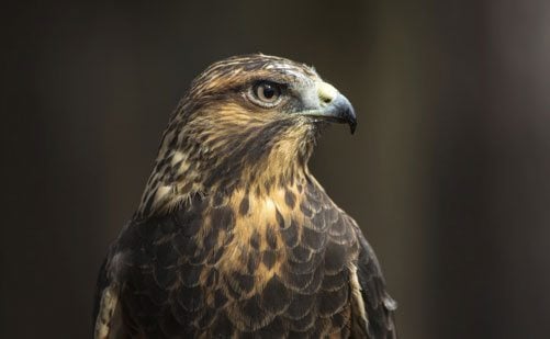
During spring migration in April and May, virtual clouds of Swainson’s hawks and broad-winged hawks can darken the sky, and sudden cold fronts produce “fall-outs” in which songbirds, dependent on southerly tailwinds to avoid exhausting their fat reserves, descend en masse to rest and refuel.
The remarkable diversity of birdlife in the Valley results from two overlapping strokes of geographic good fortune. First, the tip of Texas is situated at a migratory bottleneck in which two of the nation’s four major flyways, the Mississippi and the Central, squeeze together between the Gulf of Mexico and the Sierra Madre Oriental mountains. During spring migration in April and May, virtual clouds of Swainson’s hawks and broad-winged hawks can darken the sky, and sudden cold fronts produce “fall-outs” in which songbirds, dependent on southerly tailwinds to avoid exhausting their fat reserves, descend en masse to rest and refuel. Birders sometimes report seeing hundreds of brightly colored tanagers and warblers in the space of a single square mile.
Second, the Rio Grande demarcates not only an international boundary, but also the northernmost point for many year-round Valley specialties—including the green jay, Altamira oriole, plain chachalaca, and rare northern beardless tyrannulet—whose ranges are primarily in Central and South America. The Valley’s location at the intersection of tropical and temperate ecoregions makes it an ideal target for birders, as well as an interesting case study in climate change, since tropical species especially are already pushed to the edges of their climate suitability.
Often called “the jewel of the National Wildlife Refuge system,” Santa Ana’s status as the best place to see birds in an already bird-friendly region owes almost entirely to the availability of water, a resource that has become progressively scarcer in the Valley due to dams, drought and urban development. As the Rio Grande has slowed to a relative trickle, the refuge has been intensely managed to create an oasis of plenty in a more and more desert-like landscape.
The problem, though, is that even parts of Santa Ana are in the process of turning into near-desert. Climate models not only predict an increase in temperature in the Valley, but a precipitous decrease in average annual rainfall. Moreover, the same models show an increase in rainfall during the Valley’s rainy season—an increase that’s more than offset by even sharper decreases during the rest of the year. It’s a pattern indicative of both severe drought and stronger storms, too little water except when there’s too much. The effects of this increasingly bipolar climate are already observable at Santa Ana.
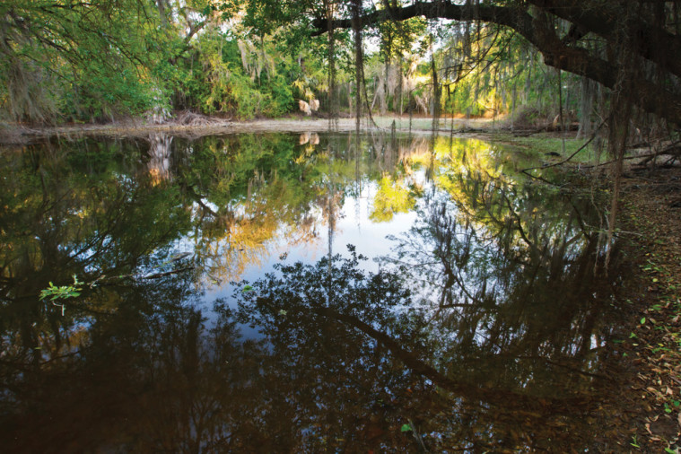
Down a muddy service road, a fleet of blue-winged teals fluttered out of the marsh cane as Chapa and I passed one of the many resacas that offer the refuge’s best habitat for wintering birds. Resacas are remnant channels of the Rio Grande, left behind as the river changed course. At one time, they would have filled with water each time the river flooded, creating seasonal wetlands. But Falcon Dam, completed in 1953, ended the river’s periodic flooding. That’s where the refuge, established in 1943 for the protection of migratory birds, comes in. “To provide quality habitat for migratory birds,” Chapa said, “we have to recreate what the river used to do by actively pumping water into our resacas.”
To illustrate, she drove me to Santa Ana’s beating heart: the pump itself. High on a bluff, the solitary blue behemoth was connected to the Rio Grande by 30 feet or so of pipe, sloped to the water at a 45-degree angle. The pump shuddered and squealed precariously, like it might be in need of an EKG. “It’s been here forever,” Chapa said, laughing. “It’s not 100 percent reliable, but it gets the job done.”
Stepping carefully down the muddy bank, we approached what Chapa called the “foot valve,” the pump’s intake, which looked something like a whiffle ball at the end of a stick. The mesh pattern was to filter debris (and wildlife) from the water drawn in by the pump, Chapa told me, but there was little danger of clogging that day; the river was so low that the valve was almost entirely above water. Until recently, the refuge could only wait for the river to rise again, but now, Chapa explained, the refuge’s pipes had been hooked up to an irrigation canal adjoining the Border Patrol road on the flood-control levee at the refuge’s northern boundary; from there, water can easily flow downhill. It’s a good backup, and a necessary one, especially given that in times of drought or high demand, farmers almost always get precedence over wildlife.
The gravest threat to the refuge, though, isn’t the result of too little water, but of too much. Or rather, it’s the product of both. In 2010, two tropical storms in one week dumped dozens of inches of rain on the Valley and the mountains of northeastern Mexico. Falcon Reservoir was pushed over capacity; when the water was released, the river rose more than 20 feet. The entire refuge was underwater, some parts for as long as 10 months, even as a severe multi-year drought set in almost immediately thereafter. It was a triple whammy: not enough water, then too much, then even less than before.
Chapa took me for a walk through a low-lying area of the refuge, where five years ago we would have seen acres of tall, leafy ebony, cypress and Rio Grande ash, collectively known as flood forest because, like the resacas, they’d once relied on moisture from the floods. The devastation was so complete that most evidence that a flood forest had ever existed here was gone, replaced by a variety of fast-growing, drought-tolerant species known as thorn scrub. Still, Chapa managed to find a few big dead trees (“snags”) left standing, far enough from the trail not to be a hazard. As we studied the snags, I asked whether she attributed the habitat change mainly to the flood, or to longer-term forces such as climate change.
Probably both, she told me. Even before the flood, refuge biologists had already been sounding alarms about the “heat stress” of sustained triple-digit temperatures and lack of moisture on the trees; the flood just sped up the process. And both flood and drought, though the close proximity of their occurrence was unusual, were examples of the extreme climate events that models had been predicting. Walking among the thorn scrub and the snags, I couldn’t help thinking that we might be looking at the Valley’s future. “I would hope that during my time at the refuge, we would have the resources to restore the flood forest,” Chapa said, “because what we have right now may not be of wildlife value.” But reforestation is expensive and time consuming, requiring heavy equipment to clear the thorn scrub and intensive labor to keep out the unwanted vegetation that invades after it’s gone—potentially for decades, until a canopy is formed to provide natural weed control. Reforestation would also require water. Even though some of the pipes are already in place to mimic the flood cycle, there are risks and costs associated with trying to restore the forest through what’s called sheet flooding. Without constant vigilance, water intended for regrowing the trees might be sucked up by guinea grass, a noxious invasive species that refuge staff is constantly battling. For now, at least, the refuge doesn’t have the resources to begin flooding again.
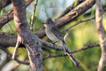
With the flood forest in danger of not coming back, birds that specialize on this habitat are at particular risk. One example is the northern beardless tyrannulet, a dusky, pint-size flycatcher that a non-birder might not even notice, but that could count as the highlight of a serious birder’s Valley vacation. The beardless, as it is known (it’s distinguished from similar species by the lack of bristles around its bill), relies on the ethereal Spanish moss hanging from old flood forest trees to make its nest. Spanish moss, which requires a good deal of moisture, is in deep decline at the refuge—and so is the beardless. The beardless’s niche is a flood forest habitat quickly ceasing to exist.
You move, you adapt, or you die,” is how University of Texas-Pan American biology professor Teresa Patricia Feria summed up a bird species’ possible responses to climate change. For specialists such as the beardless, moving is impossible, but for the vast majority of birds, packing up and leaving home might be a viable option. For that to happen, though, the right conditions must be in place. For one thing, birds need a suitable habitat in a different location to move to. For another, they require “stepping stones” of habitat along the way—many birds won’t fly over an open field, whether from fear of predation or simply of the unknown. But habitat fragmentation, due to agriculture and urban development, makes these stepping stones hard to come by in the Valley. The best hope for birds may be for biologists to plan their pathways in advance.
If we want to know how to best help birds relocate, we first need to know where they are now, and where they might want to go in the future. The Audubon report’s range maps are useful for this purpose, but they have one shortcoming: Because they don’t include (often nonexistent) data from Mexico, they’re practically irrelevant for most Valley specialties. And that’s where Feria, a native of the Estado de México and associate editor of the Mexican ornithology journal Huitzil, comes into the equation.
Before I even stepped through her office door, Feria had two brightly colored range maps up on her computer. Elegant in a red sequined shirt, matching lipstick and hummingbird earrings, she forsook any effort at introductions, launching straightaway into an explanation of the modeling process: Since Mexico doesn’t have the same tradition of bird observation and record-keeping as the United States, she explained, she had to resort to the novel approach of using museum specimens. (“My daughter always asks if I killed them,” she said. “It’s hard to explain.”) Although the sample sizes are small and also outdated—museums no longer sanction the shooting of birds for collecting purposes—the specimens do provide three indispensable data points: a name, a place and a location. With that information, Feria can enter a whole suite of environmental variables into a software program that generates a range map, like the one on her screen for a long-billed thrasher, a sweet-singing Valley specialty. Each tiny, colored box represented a square-kilometer plot of land. Red indicated “suitable habitat.” Blue meant “no suitable habitat.” In the case of the thrasher, the “before” and “after” maps showed a range that, like those of most species in North America, is shifting dramatically northward.
Modeling like this, especially when it is “downscaled” to such specific geographic areas, has its limitations. Climate “suitability” is based on historic correlations between bird populations and measurable factors including temperature and precipitation, and some species may prove better able to adapt to climatic changes than history suggests. More pessimistically, just because a potential new range offers a projected climate similar to a species’ current range doesn’t mean it will necessarily offer the right combination of food sources and vegetation. In this sense, models may actually understate risk.
Nonetheless, models provide a valuable baseline. And because it’s based on historical data, a model’s accuracy can be measured against present-day observations. “What we’re seeing,” Feria said, “is that what is happening in real life is surpassing all the hypotheses.”
Feria traced a line on her computer screen northward from southern Mexico all the way to Edinburg. “You will see the threat in the southern ranges of distribution, and expansion into the north. But what will they find here?” She worries, she told me, that such range shifts, together with rapid urbanization and development in the Valley, will spell more competition for increasingly scarce food and habitat. “Here in the Valley, a lot of birds will be coming. And we will not be prepared.”
As more data becomes available about range shifts—especially for birds already of particular conservation concern—it becomes the job of agencies such as U.S. Fish and Wildlife to help birds safely reach a hospitable destination. For this reason, the national wildlife refuge system is trying to create wildlife “corridors” to facilitate the movement not only of birds, but also of endangered mammals such as the ocelot. Santa Ana is part of a planned river corridor, the ultimate goal of which is the establishment of contiguous habitat all the way from Falcon Dam to the mouth of the Rio Grande. The river corridor, though, is a work-in-progress, a scattershot collection of mostly small tracts of land with more points of disconnect than connection. To find a corridor that might be more on par with the sweeping challenges birds face as a result of climate change, I had to travel east, to Santa Ana’s sister refuge on the coast: Laguna Atascosa.
I almost didn’t get there at all. A torrential rain had turned the refuge’s entry road into a river unto itself, and I considered turning back when the water became deeper than my tires. When I arrived 45 minutes after our scheduled meeting time, refuge manager Boyd Blihovde turned my lateness into a talking point. “As you saw, we are pretty low here,” he observed wryly. Rail-thin with deeply set eyes, he wore a brown parka identical to the one Chapa had worn at Santa Ana. (It’s a small conservation world; the two are married and have 10-month-old twins.) “You can see why one of my main concerns is sea level rise, which obviously is an effect of climate change,” he said.
In spite of the deluge, Blihovde took me out in his four-wheel drive Durango to show me the extent of the problem. Parking in the middle of a levee service road, we rolled down our windows. To the left, he explained, was a saltwater marsh; to the right, a freshwater lake. The difference wasn’t hard to see. Most waterfowl require fresh water, and the lake teemed with a dozen species of ducks, including a ruddy duck, striking with its sky-blue bill and rich chestnut breast.
“You move, you adapt, or you die,” is how University of Texas-Pan American biology professor Teresa Patricia Feria summed up a bird species’ possible responses to climate change.
Usually, Blihovde told me, the marsh is a dry sand flat, but the spring rainfall had made it easy to see his ultimate concern: Unlike ocean tides, the tides in the refuge-facing Laguna Madre are almost entirely wind-driven, and all it would take is one “superstorm” to push the water over the levee and turn the fresh water salty. Rising sea levels, along with the increasing probability of strong storms, are making this scenario—the technical name is salt intrusion—more and more likely. And once it happens, it’s practically irreversible.
It would also be catastrophic for wildlife, especially for species such as the redhead duck, 80 percent of whose worldwide population winter at Laguna. A little farther down the road, we got out of the truck and walked to a scenic overlook. My binoculars were clouded over, but I didn’t need them to see the aptly named redheads, gathered by the hundreds 100 yards or so offshore. (I also saw in the distance dozens of great blue herons and a single rare reddish egret dancing along the shoreline of the Laguna Madre.) “We have a decision to make,” Blihovde said, gesturing at the levee. “Do we want to keep building this higher, further armoring the coastline? Or do we want to find other freshwater sources in other places, and do a managed retreat over time?”
In general, Blihovde explained, these are the two philosophies on helping wildlife adapt to climate change: “stand-and-fight” and “managed retreat.” In places like Santa Ana’s flood forest, or a levee separating fresh and salt water, there may be no choice but to stand and fight for habitat that, without significant human intervention, would almost certainly vanish. For most species, though, managed retreat—helping wildlife find another suitable habitat, perhaps farther north or inland—is the only practical solution.
While managed retreat didn’t sound too promising to me, Blihovde said he’s actually optimistic about the future of birds in the Rio Grande Valley. Back at his office at refuge headquarters, Blihovde unrolled a map to show me why. The protected areas were highlighted in green, and the picture looked considerably more promising than the maps I’d seen of the river corridor. In addition to Laguna’s two major units—encompassing 97,000 acres—additional habitat was protected by the Nature Conservancy and private landowners. If I used my imagination, I could see what Blihovde clearly saw already.
“If these lands are connected,” Blihovde said, running his hand over the map from Mexico north past Kingsville, “they’re just immensely more valuable for wildlife protection.” In Mexico, he said, more than a million acres bordering the lower Laguna Madre have been protected by the Mexican government. To the north is what has been called the “Last Great Habitat”: millions of acres of pristine habitat, most of it privately held, in the Texas ranch country. (“The King Ranch, Kenedy Ranch, Yturria Ranch, El Sauz, East Ranch—you could just go on,” Blihovde said.) Some of these ranches already have conservation easements incentivizing wildlife protection, while others are working ranches, for which habitat maintenance is a way of life. Together, they represent a vast potential habitat for bird species shifting their ranges northward—if they can get there in the first place.
The problem is a missing link. Blihovde pointed at the refuge’s two major units, and then at the relativelyslender strip of land separating them, north of Brownsville. U.S. Fish and Wildlife is in the process of trying to acquire land in this area and, perhaps more important, work with local landowners interested in conservation. But as the pace of development in the Valley accelerates, time is running out. “We’re in a bind here,” Blihovde said, “where we have some time, when the prices aren’t too high yet. But one road, and the infrastructure gets put in…”
He began rolling up his map. “In my mind, we’ve got five to 10 years to do something, and 10 years might really be too optimistic. Once it’s concrete, it’s too late.”
You May Also Like
Texas’ Refusal to Plan for Climate Change Created a Crisis in Corpus Christi
Stubbornly unrealistic assessments of the region’s reservoir system turned this year’s drought conditions into an emergency.

Deaths Uncovered in Laredo Show the Ongoing Toll of Border Militarization
“The people we’re finding now dying on the U.S. side of the border are the people who could not wait.”
Texas Nights Are Getting Hotter, and the Power Grid Isn’t Ready
The state grid was built on the assumption that demand would fall at night. As hotter evenings and around-the-clock power use erase that drop, the system is being pushed in ways its original design did not fully anticipate.