by Zoë Schlanger
August 22, 2018
–
“This is absolutely abysmal,” David Gutzler said in March 2018, speaking to an auditorium full of US and Mexican water engineers and hydrologists in El Paso, Texas. He was talking about the state of the snow in Colorado at the time, the snow that would melt and feed the Rio Grande in summer. There wasn’t enough.
The University of New Mexico climate scientist pointed to a slide showing a chart of year-to-year levels of the snowpack that sustains the upper half of the Rio Grande, which snakes through New Mexico before turning south to become the border between Texas and Mexico for 1,250 miles (2,011 km) all the way to the Gulf. “There is essentially zero chance that we will obtain anything close to average snowpack this year,” he said.
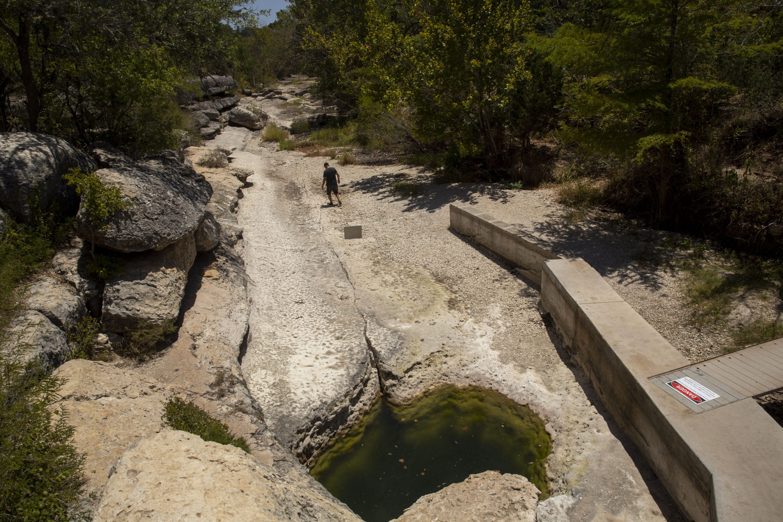
Gutzler turned out to be right. The snowpack measurement taken a few weeks later, on April 1—traditionally used as a proxy for the region’s anticipated water supply for the coming summer—was at just 48% of where it should have been (pdf). By May, some stretches of the upper Rio Grande that normally don’t run dry until August were already desiccated. Southern New Mexico, the part of the state fed by Rio Grande water, would have to depend entirely on water stored in reservoirs to make it through the summer.
[wd_hustle id=”FeaturesNewsletterSignupcopy” type=”embedded”]
That’s what the reservoir water is for, of course. It’s an emergency stash, to get through bad drought years. But what if the drought lasts a second year—or five more?
“We are eating into our savings at a very rapid clip,” Gutzler said in late May. “If something like this happens again next winter, then we’ll be in big trouble.”
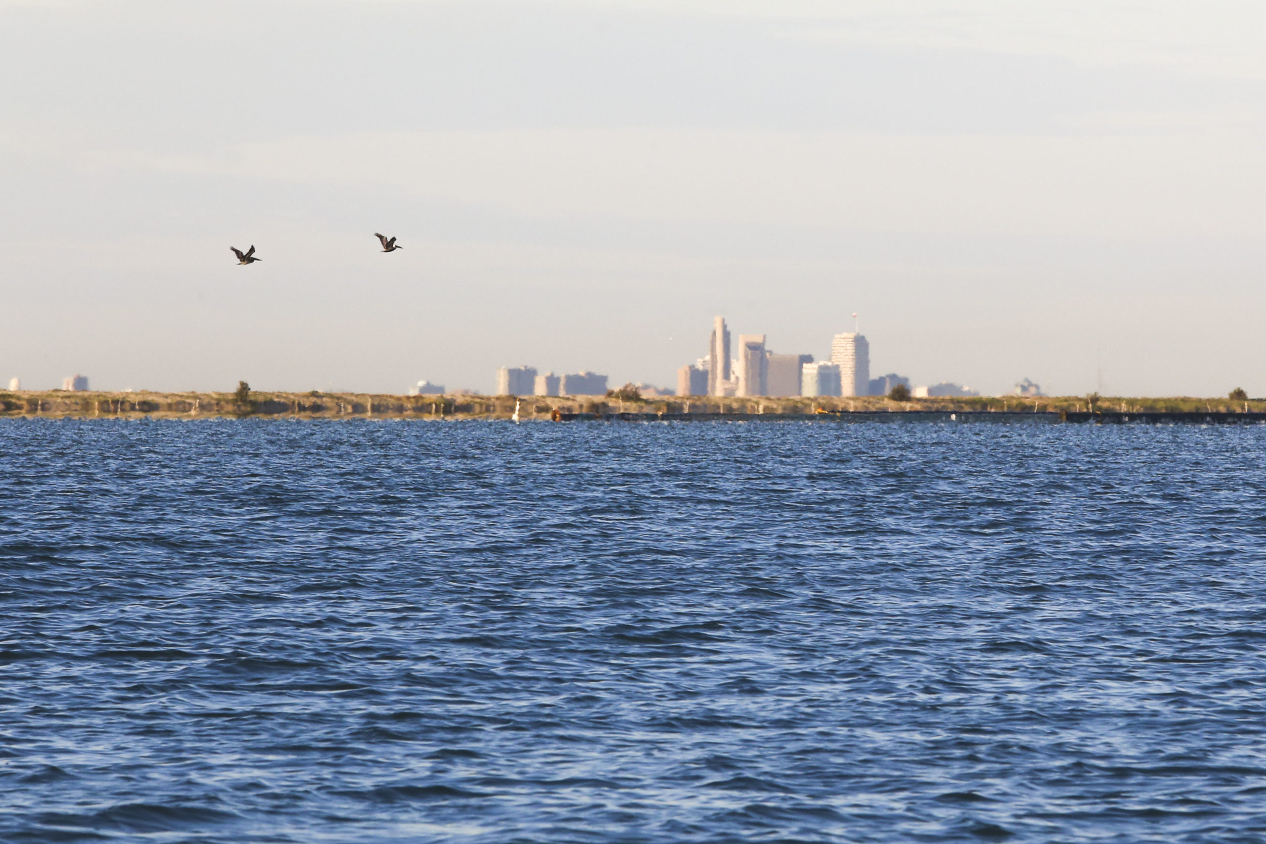
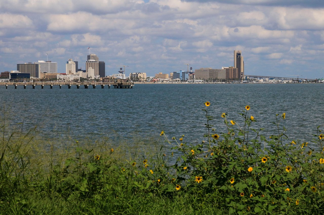
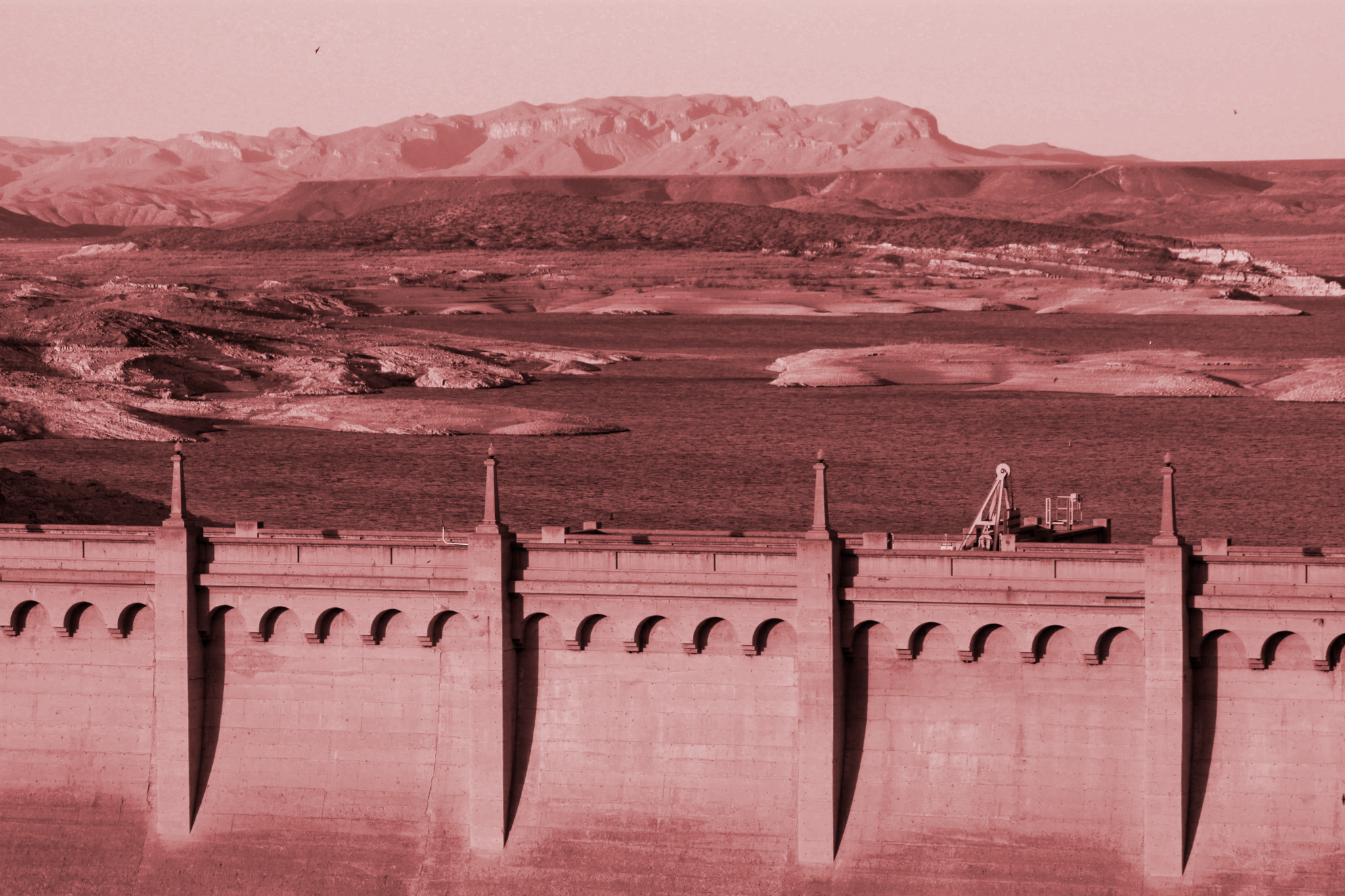
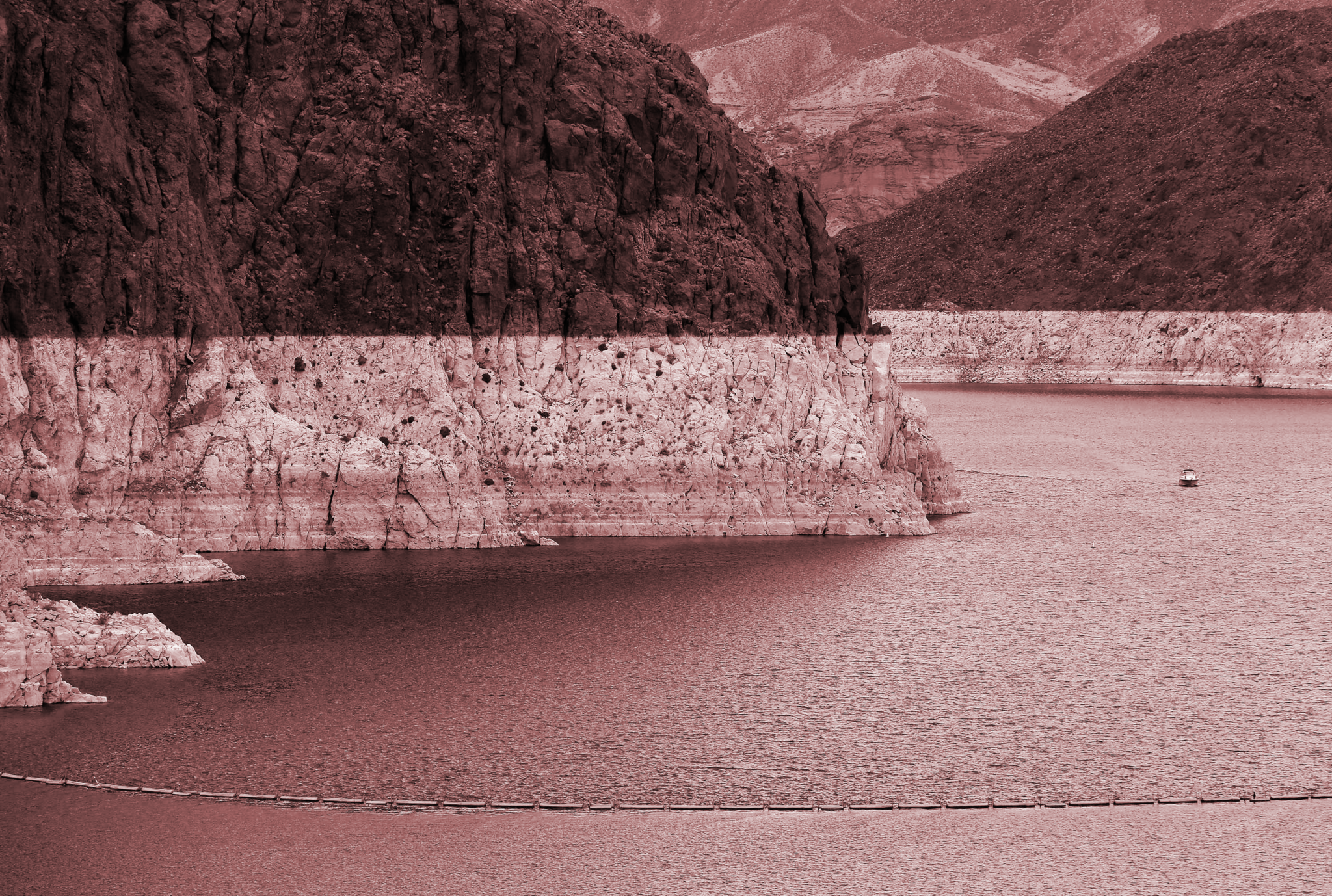
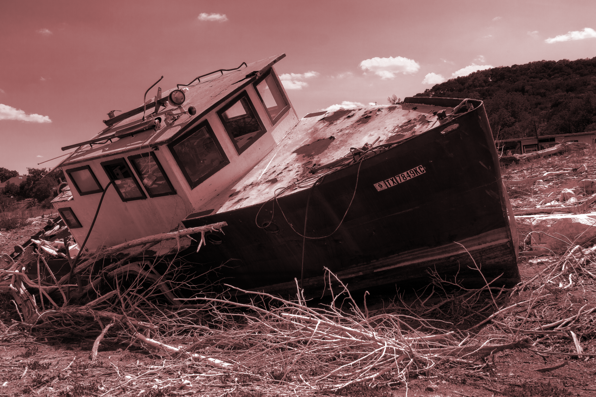
As the summer progressed, farmers along parched parts of the Rio Grande had to call in their stored water rights to get through the growing season, since their canals from the river were running dry. The Elephant Butte reservoir, by far the largest reservoir on the upper Rio Grande, was just 6% full at time of publication—down from 24% full six months prior.
The snowpack that supplies the upper half of the Rio Grande has decreased 25% in the last 40 years. Gutzler predicts that, by the end of this century, average upper Rio Grande flows will drop by 20% from 2000 numbers.
The lower half of the Rio Grande isn’t dependent on the snowpack; it’s largely fed instead by the Rio Conchos, a river filled by monsoon rains in summer. The Conchos runs south-to-north from Mexico, connecting to the Rio Grande near the towns of Ojinaga on the Mexico side of the international border and Presidio on the Texas side. It’s much harder to predict what effect climate change will have (or is already having) on the Mexican monsoon, Gutzler says. “But all else being equal, warmer temperatures increase demand for water.” And temperatures are definitely going up.
“It’s possible that the next big megadrought is upon us, and we’re right in the middle of it,” Gutzler says. “We’ll know it’s ended after it’s ended, but not before.”
Phone booths of perception
Water in the North American Southwest is governed by chaos. A bad drought happens roughly twice a century, but there seems to be no discernable pattern beyond that. And then there are the unpredictable “alluvial” periods, when the pendulum swings the other way and rain falls, snow builds on the mountains, and rivers run full.
These alluvial periods can last a decade or two—enough for people to get comfortable. From a human perspective, anything that continues for a few years starts to seem normal. Sociologists call this “shifting baseline syndrome.” Falling into this trap can lead to devastating mistakes.
The North-American Southwest was in a wet period when the Colorado River Compact (pdf) was signed in 1922, splitting water rights among the seven US states the river wends through on its way to the border with Mexico. To divvy up the river’s water, negotiators needed to know how much was actually there. So they looked at the historical record, which at the time was a grand total of 25 years of data, and took an average: 17 million acre-feet (pdf)—a nice, round, big number.
But there was a problem: 25 years isn’t very long. And it just so happened that those 25 years were an unusually wet period, and 1922 was, essentially, the end of that sodden run. No one knew it back then. The most qualified thinkers of the time made a hugely influential decision based on the equivalent of a climatic sneeze.
What the trees know
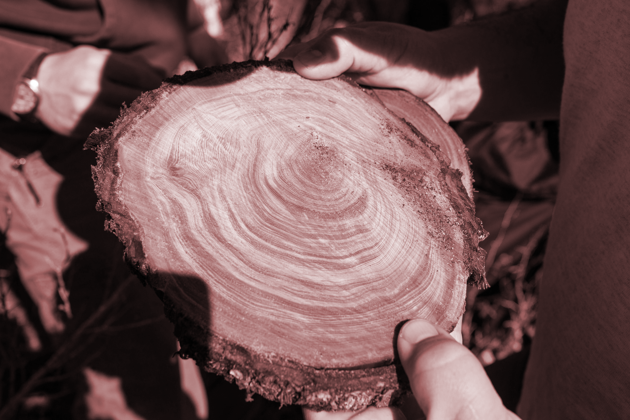
Each year a tree lives, it adds another sheath of woody tissue, another layer that thickens its trunk. A crosswise slice reveals these layers as rings, each telling a story about what life was like for that tree that year. Trees are resilient organisms, many able to live multiple centuries through repeated droughts by simply not attempting to grow when there isn’t enough water. The thickness of a tree ring is a direct proxy for how much water a tree could find for itself—drought is spelled out right there in the wood, in the thinnest rings. “It’s the most accurate and precise dating measurement in geochronology,” says David Stahle, a University of Arkansas dendrochronologist, who studies environmental change using tree rings. “[Trees] really are nature’s library of environmental history. An archive.”
They’re also the best way to stretch human knowledge about the climate back longer than humans have been keeping records themselves—and great at fact-checking short-sighted human folly. The Colorado River Compact negotiations, the tree archive revealed, “was a period of abnormal wetness compared to the last 1,000 years,” says Stahle, and that “skewed our expectation of wetness.”
The river system is still suffering the consequences. In recent years, the beleaguered Colorado has been overallocated by roughly 3 million acre-feet a year on average—enough to submerge the entirety of Belgium in half a foot of water (or Hong Kong in 11.5 ft of water). In other words, water rights-holders are promised a collective total 3 million acre-feet of water that doesn’t actually exist. In particularly dry years over the last few decades, its actual flow has been recorded at less than a third (metered paywall) of the 17 million total acre-feet allocated by the compact. By the 1990s, the Colorado River delta in Mexico was transformed into a desert (metered paywall). “We live in these telephone booths of perception,” Stahle says.
We only have records of streamflow and precipitation going back 100 years, a mere thimbleful of data in the sea of geologic time—especially when the sample size of actual droughts is two. “We know from tree-ring studies that a century really isn’t enough time to sample all of the natural variability that can happen here,” says Stahle. When he uses tree rings to look at climatic patterns over 1,000 years, more megadroughts pop up. Some, he says, “look much more severe than what we’ve seen in the last century or so.”
One such megadrought began around 1140 AD and lasted decades. Some anthropologists date the collapse of the Mimbres culture (pdf) in the North American Southwest to the middle of that drought, and believe it was this climatic event that led to their downfall.
The last true megadrought in the region occurred when indigenous tribes of the North American Southwest first came into contact with European explorers and settlers in the 16th century. That one lasted at least 20 years, according to the tree rings. It wasn’t easy for dendrochronologists to figure out; there were few arboreal survivors. The 500-year-old trees used to date the drought were found in secluded nooks and crannies, escarpments and cliff faces protected from the forest fires that came with the epic drought, and which destroyed almost everything living in the region.
The dates of the drought correspond to a “megadeath” among indigenous people in Mexico; somewhere between 7 million and 17 million people died from 1546 to 1576, likely of hemorrhagic fever carried by rodents. That represented as much as 80% of the region’s total population. In relative terms, it was nearly as severe as the Black Death that struck Europe in the 14th century, which killed 25 million. Stahle and his colleagues posited in a 2002 paper that the extreme drought, combined with the squalid, slavery-like conditions suffered by indigenous people under colonial Spanish occupation, caused “aggravated transmission” of the disease.
We now know climate change is speeding the spread of infectious disease widely across the globe today, as well as contributing to heightened death rates in other ways, including heat exposure. The World Health Organization estimates climate change contributes to 150,000 deaths each year now, with that number likely doubling by 2030.
A megadrought could raise the risk to humanity in North America even further. We know those last two megadroughts fell roughly 300 years apart. The last one was 500 years ago. It isn’t a stretch to say we might be overdue.
The Next Big One
Weather extremes are natural; the history of Earth is one of incredible climatic variability. “There’s been this waxing and waning of the ecosystem of North America over geologic time,” Stahle says. For example, the Mojave Desert of the Southwestern US was dotted with lakes and likely lush with greenery some 15,000 years ago, at the close of the last ice age.
But humans have made things much, much worse. “The real concern is the human alteration of regional and global climate,” says Stahle. “It renders the future more vulnerable to the natural occurrence of these extremes.”
Burning fossil fuels has exacerbated the chaos in the system, tipping the balance towards hotter, drier weather in the North American Southwest. Models aren’t yet good at predicting climate change’s impact on precipitation, but in 2016, researchers at Cornell University, Columbia University, and NASA published a study suggesting the current trajectory of warming pushes the likelihood of megadrought in the region above 70%. If there’s also a decrease in precipitation over the North American Southwest due to normal climatic patterns, would increase the possibility of a “searing megadrought,” starting before 2100 and lasting more than 35 years, to 99%.
Doing something to curb carbon now would make a big difference. “An aggressive reduction in global greenhouse-gas emissions cuts megadrought risks nearly in half,” the researchers wrote.
We won’t know until we know
It’s not totally hopeless for the North American Southwest. Experts say when there’s less water, people tend to find ways to go without, and governments can respond right now by implementing new water rules. Australia, for example, just endured what may be the closest thing to a megadrought the world has had so far this century. After 14 years of severe drought, the rain started falling again in 2010. Australia has been the world’s most arid continent for all of recorded history, but it had never seen anything like this. People started using less; a few years into the drought, Melbourne residents cut their water use in half.
Afterwards, the Australian government doubled down on the country’s unique groundwater market, in which users own a share of the water predicted to actually be available that year, as opposed to owning rights to a set volume of water in perpetuity. Water is always a wildly fluctuating system; assigning shares of water, instead of some absolute value, takes that into account. In 2012, in the wake of the drought, Australia expanded the water market, making it easier for farmers to buy or sell their allocations and negotiate their own prices. That means an Australian farmer who wants more water in a dry year must convince another farmer—likely also struggling to make do with what they have—to sell their allotment. That creates a natural limit on water use during periods of scarcity. According to the water-policy site Circle of Blue, withdrawals are closely metered, so illegal pumping is rare.
Meanwhile, drinking water for cities and towns is protected, and the Australian government purchased allocations to keep at least some water flowing in the country’s rivers no matter what, so they would never be completely drained. The system isn’t perfect, but it is a way to live better under long-term drought conditions. After weathering a megadrought, Australians live with the assumption that it could happen again.
“We have much better tools and awareness of the…things that can happen in this kind of system than we did a decade or two ago,” Gutzler told his border-water conference audience in early 2018. “The Mimbres probably didn’t know what was going to hit them. But we know [it could]. We would be foolish not to plan for what could happen.”