Floodplains Belong to the Rivers
From Houston to the Hill Country, we Texans keep doing the same thing over and over while expecting a different result.
I’ve had it with hearing the same story over and over again—another 100-year-plus rainfall event, another tragic result from people occupying the floodplain without an adequate warning system. More pain. More loss.
The bottom line is—we Texans keep doing the same thing over and over and expecting a different result. We are not going to change this narrative until we change our view of climate change and of living and developing in the floodplain.
The storm that hit Kerrville was similar to prior rainfall events from 1987 and 2002 that led to flooding on the Guadalupe River. (As well as more historic floods, like one from 1932.) Those risks were known, though perhaps the rainfall intensity and rate of the river’s rise were a bit more extreme than in the past.
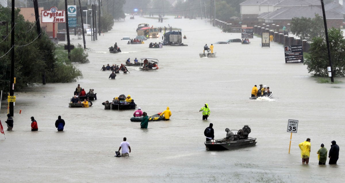
The intensity of the storm in Kerrville and its failure to move was similar to what Houston saw with Tropical Storm Allison in 2001 and Hurricane Harvey in 2017. Texans are experiencing larger storm events over shorter time periods.
Our climate is changing and our rainfall patterns—and drought patterns—are proving it repeatedly.
After Harvey, the National Oceanic And Atmospheric Administration (NOAA) redid the historic rainfall analysis in NOAA Atlas 14. In the process, the standard for what is defined as a 100-year flood was updated for Houston from about 13 inches of rainfall in about 24 hours to about 17 inches in 24 hours, an increase of more than 30 percent. However, Dr. Phil Bedient of the Severe Storm Prediction, Education and Evacuation from Disaster Center (SSPEED Center) at Rice University is of the opinion that that is an underestimate, given that Houston has experienced five storms since 1995 that exceeded even that new 100-year rainfall amount.
The science is clear. The Earth’s atmosphere is getting hotter with global temperatures rising about 1 degree Celsius on average from 1900 to 2000. A hotter atmosphere can hold more water than a cooler one, and hotter temperatures lead to more evaporation. And with tropical systems such as Barry that hit Tampico five days before the Hill Country flood, massive amounts of tropical rain arrived further inland.
But rather than raining out over the mountains of Mexico as predicted, much of Barry’s atmospheric moisture made its way to Central Texas where it fell in a concentrated area. A low-pressure system just sat over the Hill Country, flooding not only the Guadalupe River area but also the Llano, San Saba, and San Gabriel Rivers north and west of Austin where people also died.
What this tells me is that our Texas rivers, bayous, creeks, and streams are more flood-prone today than ever. Although Texans have been doing flood-prevention planning, most of those analyses are based on the statistics from past storms without attempts being made to better define the current reality. More importantly, we don’t treat floodplains with the respect they deserve and demand.

I was around when the first floodplain maps were developed in Harris County in the late 1970s. I watched these maps being treated like political footballs since land-use controls affected areas designated as floodways or 100-year floodplains under federal law.
State and local leaders treated this new regulatory effort with contempt, with some calling it a federal intrusion that interfered with private land-use decisions. Due to controversy over the initial maps, Harris County became the first county in the United States given permission to do its own floodplain mapping. Over time, I watched the mapped floodplain on some of our bayous changing from larger to smaller and back again throughout the 1980s and into the ’90s.
When Allison hit in 2001, we remapped Harris County floodplains to update for new development that had added more concrete and more drainage channels—changes that had increased the flooding downstream. But the estimated rainfall amounts were not adjusted at that time. Instead, Allison was treated as a freak event, way beyond a 100-year storm. Then Hurricane Harvey came along—a storm that some said was a multi-thousand-year storm. And then Imelda arrived in northeastern Harris County, once again breaking records.
After NOAA adjusted its rain estimates, Harris County and the City of Houston adopted the 500-year floodplain for regulatory purposes and new floodplain maps were commissioned in 2019. But we’ve been waiting for them to be issued for six years now.
I do not know why we have reached mid-way in 2025 without new maps. I know that they will be painful when published. I know that as much as 30 to 40 percent of Harris County may end up in the 100-year floodplain. And I know that as many as 150,000 or more homes will be inside these floodplains. I also know that these areas are much more dangerous now with more intense rain events.
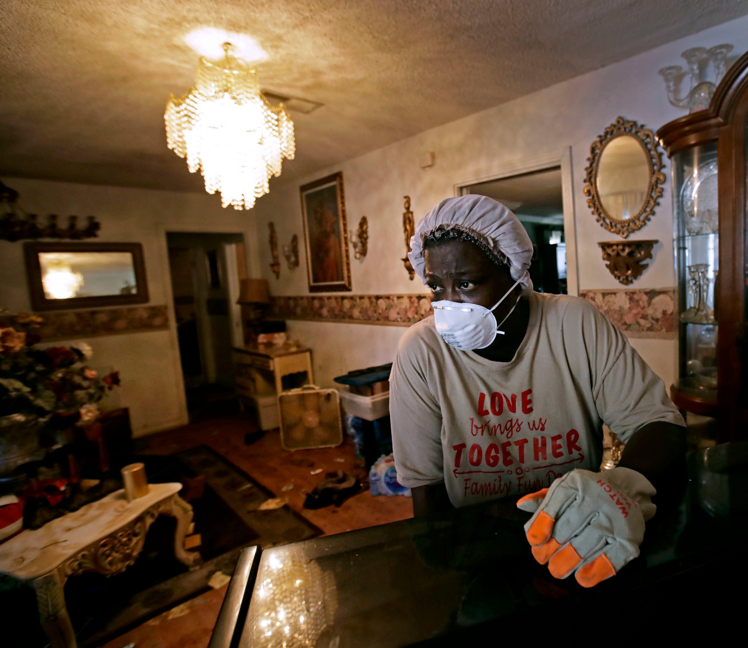
Houston and Texas need to get smart about floodplains. The rainfall flooding we experience in Houston is typically gentler than the raging wall of water that came down the Guadalupe River, but it is no less damaging. You may avoid death, but your property will be damaged, and first responders could be put at risk trying to rescue you.
We need changes. First, we need to make a commitment to understand our changing climate and address it honestly. We need to fully fund NOAA and the National Weather Service and the Federal Emergency Management Agency (FEMA). We need to develop comprehensive flood warning systems that can better alert potential flood victims. We need floodplain maps that are accurate and dependable. We need an engineering community that understands and honestly conveys what science is telling us. And we need to evacuate floodplains as efficiently and as soon as we can.
Floodplains belong to the rivers. For too long, we have tried to make them part of the property of humans and a place for human habitation. That simply cannot continue—not without more tragedies like those we have just witnessed on the Guadalupe and in Houston.
You May Also Like
Samantha Montano Has ‘Disaster Vision’
A new book explores past natural disasters and how Texas remains unprepared for future storms, big and small.
Communities of Color in Houston Will Face Another Hurricane Season Without Adequate Flood Control
After nearly $4 billion in county and federal funding for infrastructure projects, the city’s most vulnerable neighborhoods still aren't protected.
“People Are Wiped Out”: Costs Pile Up as Hurricane Season Begins
Hurricanes, a winter storm, and spring floods have left low-income Gulf Coast residents exhausted and cash strapped before this year’s season, with no significant aid in sight.