The Unseen Sabine River
A version of this story ran in the July 2014 issue.
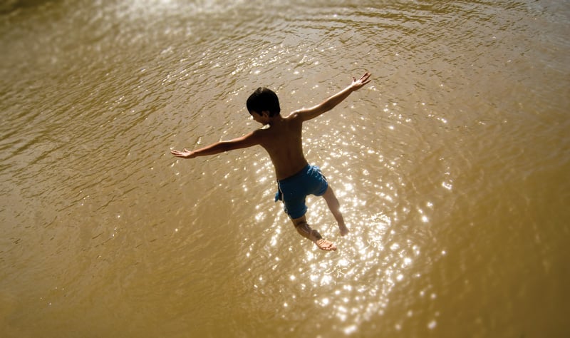
Above: Taking flight at a Sabine River swimming hole.
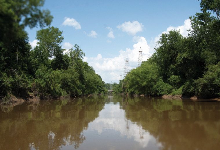
Concrete ruins crumbled along the water’s edge. The ancient, abandoned structures were strewn about the banks, slowly being swallowed by vines from the encroaching forest. Jacob steered the boat while I perched on the bow and stared at pairs of enormous pillars that rose from either side of the river like monuments to a vanished people. Within minutes of our first morning along the Sabine, our trepidation surrendered to awe. We skirted wooden platforms that rotted in the water, while rusting pipes swayed in the current.
The water was calm and greenish-brown in the morning light, much wider and less cluttered than it had been the day before. At lunchtime, we tied our boat to a leafy tree limb that shaded the water. We swayed in the gentle current. Tall oaks and elms crowded the opposite bank.
“It’s so beautiful down here,” Jacob said. “So much prettier than I think about it.”
East Texas is also hillier than many people realize. Pressing on, we passed bluffs that towered 30 or 40 feet above the river. On one, cows rested under pine trees, watching us as they chewed. As we approached Texas Highway 42, a few miles south of White Oak, houses began to appear on the southwestern bank. A black dog swam in the water. Maybe his owner was nearby.
Sure enough, the dog led us to Don McClendon, a man who wore a handlebar mustache, Red Wing boots, and a pair of short pants. Before we interrupted him, he had been spending his afternoon riding an old John Deere tractor, leveling dirt at his future homesite overlooking the river. McClendon said he grew up nearby, exploring ancient Indian hunting and fishing grounds.
“I’ve found a zillion arrowheads down here,” he said. “Down about 20 feet from where your boat’s parked, there’s an old Indian fish trap.”
If you know where to look for them up and down the river, you can see Indian fish traps late in summer when the water’s low. Native Americans gathered river stone to build U-shaped walls resembling jetties. The walls block the fish’s passage through the channel, leaving them easy prey for a fisherman’s spear. Archeologists have not studied the traps, but according to local lore, they belonged to the Caddo, who had been living on the Sabine River basin for around 800 years when the Spaniards arrived in the 16th century. Long before the Caddo, the basin was home to the 13,000–year-old Clovis culture, whose fluted spear points McClendon and others still find on banks and riverbeds.
McClendon looked across the river, admiring the view. “It’s a peaceful place to sit and drink coffee in the morning. You’ll talk to people who just think the Sabine River is an old, nasty, muddy river, but we swam in it all our lives, skied in it. It’s just like a lake, but it changes every year. When it floods and goes back down, there’s always something different.”
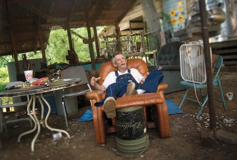
McClendon told us we needed to meet his downriver neighbor, Elton Wayne Woodall. We found him sitting on a high bank at the sprawling shack that he had been building, piece by piece, since he moved in ten years earlier.
“I’ve lived on the river a pretty good while,” the old man told us. “I was born and raised here, and I’ve been as far as you can go both ways.”
Woodall was a lifelong trapper. Before he got sick a few months earlier, he had snared beavers, raccoons, bobcats, and river otters along the Sabine. After he caught a critter, he skinned and stretched it. He worked in a little blue shop that he had built on an island in a pond in the middle of his front yard. A wooden bridge led from the yard to the island. The island gave him privacy to work. Woodall sold the pelts to a distributor in Canada, and he also caught and sold catfish to the general public. “Just show up and ask for them,” he said. “I’ve got them in the freezer. Don’t know how many I have left, since I’ve been sick two or three months.”
Woodall figured the nature of his illness was nobody’s business but his own. It was serious, though. On the day we met him, the last Wednesday in June, he seemed much older than his 60 years. He rested in a leather recliner under the tin-roof carport next to his house. An industrial-sized box fan blew cool air on his face.
I had never heard Woodall mentioned until that day, although we lived in the same rural community and had both been educated in a school system named for the river: the Sabine Independent School District. When he was a child, Woodall said, his father ran trotlines on the Sabine, and Elton and his friends floated the river on inner tubes. Over the next 40 or 50 years, the river had changed dramatically, he added, especially in regard to the oilfield equipment that has been left to decay along the riverbanks. The ancient structures that Jacob and I had discovered that morning were relics of the East Texas oil boom that began in the 1930s and continues to define the region, Woodall told us.
Oil and the Sabine have not always mixed well. “When I was growing up,” Woodall said, “you couldn’t even eat the fish in this river it was so polluted.” Oilfield companies “just dumped that saltwater piss into the river, and the fish tasted bad. We had to fish above Gladewater to get fish we could eat. But it’s been cleaned up, and there’s good fishing now. The fish taste fine.”
Jack Tatum, manager of the Sabine River Authority, had also told us about efforts to clean the river. Some East Texans might think their river is dirty, but that is not the case anymore. “The river’s in better shape than it’s been in many, many years as far as water quality,” he said. “We’ve come a long way in protecting our water. Generally speaking, the water quality is excellent throughout the Sabine watershed.”
In the 1970s and 1980s, following passage of the Clean Water Act and action by the Environmental Protection Agency, the state government began cleaning the Sabine and other rivers of wastewater contaminants. Regulators streamlined the standards for water that pours into the river from industries and sewage treatment facilities, and the river authority and the Texas Commission on Environmental Quality (TCEQ) continue to monitor the Sabine and its tributaries.
Especially downstream from the industrial town of Longview, the Sabine’s watershed sometimes has low levels of dissolved oxygen, which can harm fish. A couple of monitoring sites occasionally show high levels of bacteria after heavy rainfalls, but the river water is generally safe, according to river authority reports. There are no restrictions on fish consumption or bodily contact with the Sabine River water.
For the most part, data maintained by TCEQ support Tatum’s assertions. But in the recent book Water in Texas: An Introduction, rivers expert Andrew Sansom identifies a notable exception or two. “Development of oil refineries, shipping facilities, and wastewater discharges,” Sansom writes, “resulted in the deterioration of the water quality of the Lower Sabine River, which, although being addressed, still remains a problem.”
Wild animals are also beginning to thrive again on the Sabine, according to Woodall. Now that so few people are farming beside the river, the cotton fields and vegetable plots that once were plowed right up to the banks have gone fallow and reverted to wilderness, providing new habitat for deer and other game. Woodall, sitting beside his box fan, said the Sabine was now home to more wildlife than at any other time in his 60 years. He cited the previous weekend, when his grandchildren had snagged around three dozen frogs.
“They go up and down the river catching bullfrogs with their hands. They’re really good eating,” he said. “We fry most of them, just like fried chicken.”
The afternoon grew late, and Jacob and I were ready to move on, but not before a caution from Woodall: “Y’all be careful. You can turn a boat over in that river. I’ve done it a hundred times.” Just as Tatum had warned, Woodall told us to watch for the weir hidden beneath the water between the next two highway crossings.
“It’s bad dangerous,” he warned. “I sunk my boat there in January and nearly drowned. Make sure you get out and have a look around before you do anything.”
We promised we would and told him goodbye. As we left Woodall’s place, old oil derricks stretched up from platforms on the water around the Highway 42 bridge. The river seemed to narrow, and we dodged frequent trees that clogged the channel. A few miles downstream from the highway crossing, we had to stop. A pair of trees had fallen from opposite bluffs. They formed a wall where they met in the middle of the river, snagging logs and limbs in a massive tangle of woody debris.
There was no way around. The smaller of the two trees lay mostly submerged, peeking two or three inches above the water’s surface. Only the day before, wildlife biologist Shaun Crook had jumped us over a similar log in his Texas Parks and Wildlife boat.
“Oh, we got this,” I said.
Jacob, the level-headed one, was not so sure. The logjam diverted the swift current under and around itself, and he feared that if the boat struck high center, it would be sucked into the water’s path and spun sideways. If that happened, we would quickly capsize. To make matters worse, a sharp knob jutted from the smaller tree in the only place we thought we could cross. It would be disastrous to gash the bottom of our borrowed boat.
We docked to have a look around. Clinging to exposed pine tree roots, we scrambled up a steep bank of red clay, and I climbed onto the logjam itself to see if I could untangle it somehow. All I did was startle a long, gray snake that slithered deeper into the jumble of tree limbs. What to do? If we unloaded our gear and somehow hoisted the 16-foot-long boat over the bank, we thought we might be able to drag it about 100 yards along a game trail and then put back in just downstream of the logjam. It was an hours-long project.
As if on cue, storm clouds rolled in, dark and ominous. We had to go for it. We gunned the boat toward the lower log to hit it full speed and jump it, hoping we would not crush the propeller. The boat raced forward. But at the last second we veered away. We gunned it a second time. We got closer. We were almost upon the log when we turned off again.
“I just can’t do it,” Jacob said. “I’ve never gone over anything like that.”
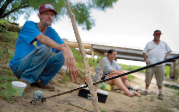
Defeated, I called my brother and asked him to come pick us up. As we backtracked to the highway crossing, the first of the raindrops stung our faces and spattered the river. Back at the highway bridge, a man named Ronnie King Jr. was loading a tank-sized boat onto his trailer at a private ramp just off the roadway. King, from nearby White Oak, had spent the afternoon riding the river. He said our logjam was pretty easy to cross when heading downstream. It was only a little trickier on the ride back up, he added. That didn’t make us feel any better.
“When you’re about to jump a log, run it like it’s stolen,” he advised. That meant driving as fast as you can. King gave us his phone number and the number of a few of his buddies. “We run the river pretty hard,” he said. “If, God forbid, you lock a motor up, you give us a call and we’ll get you drug out of there.”
It was only our second day on the river—our first by ourselves—and already the trip was in peril. What if we had gotten over the logjam only to face another, bigger one just a few miles downstream? My brother Dan showed up. He was not amused. He rolled down his window and shook his head. “I hope this isn’t a sign of what’s to come,” he said. I hoped so, too, but I really had no idea.
Excerpted from Running the River: Secrets of the Sabine (Texas A&M University Press, 2014).
You May Also Like
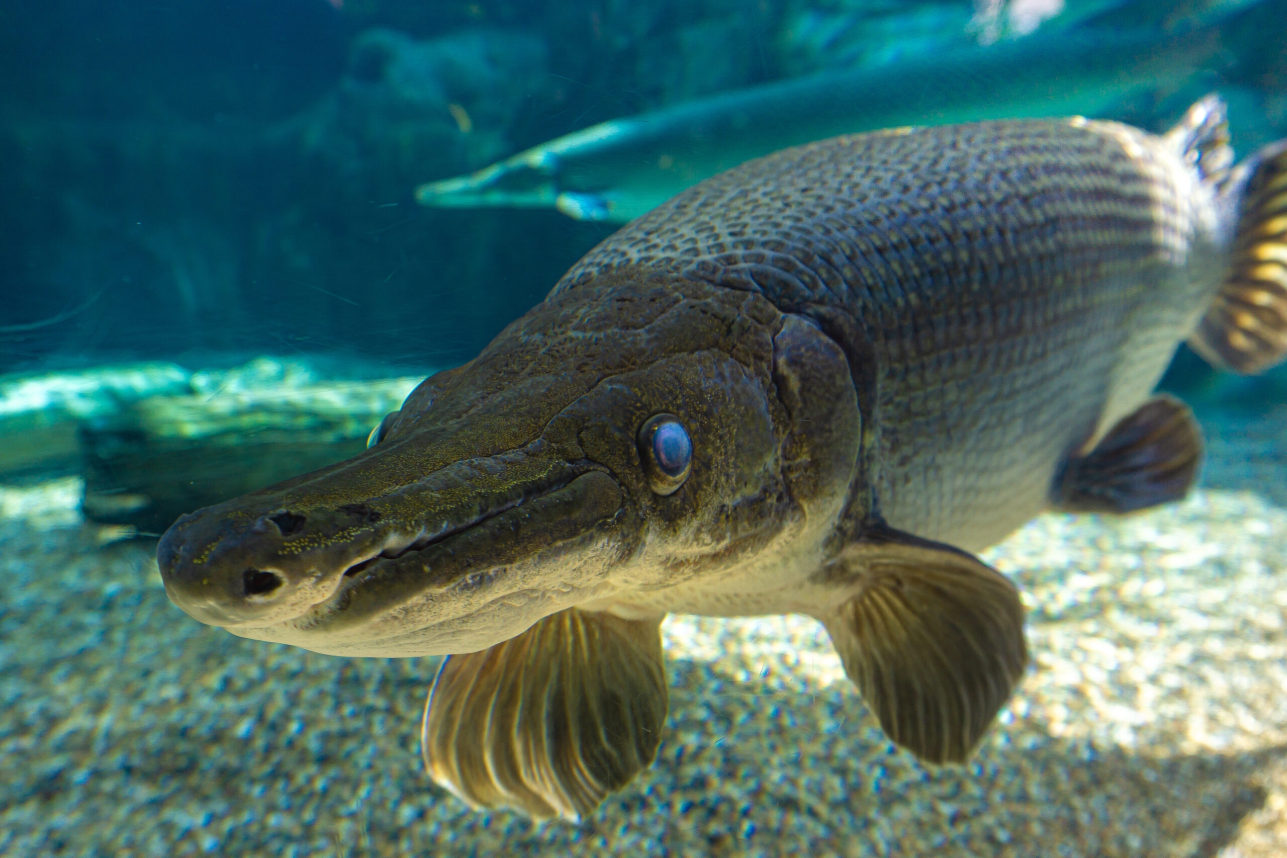
Strangest State: Ken Paxton and Other Odd Creatures
Impeachments, record-breaking alligator gars, and other rarities from far-flung Texas.
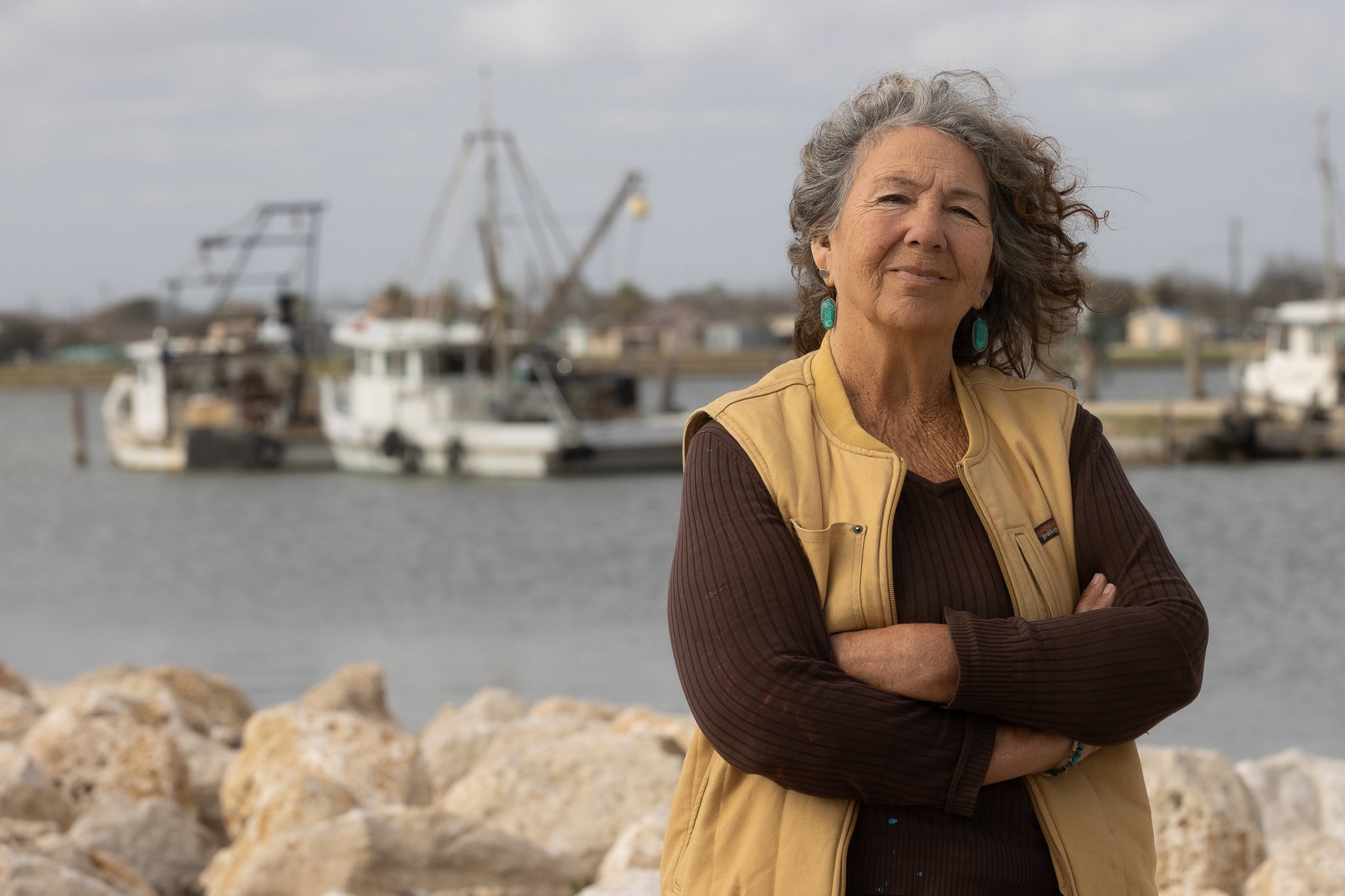
Diane Wilson on Fighting Plastic Pollution, Losing Everything, and Gaining Her Soul
The longtime Gulf Coast activist just won the prestigious Goldman Environmental Prize.

‘The Fishermen and the Dragon’ Uncovers Racist Conflict in Galveston Bay History
A new nonfiction book reveals dark details of a clash between white and Vietnamese shrimpers, corporate polluters, and the KKK in Texas.